The BC Electoral Boundaries Commission will hold public meetings in Nelson and Trail next week.
The group charged with reviewing BC’s electoral map will stop at the Hume Hotel in Nelson on Monday at 8:30 a.m. and at the Trail Chamber of Commerce the same day at noon.
There will also be a virtual public meeting for these regions on Monday, April 11.
“We are eager to hear from residents,” Justice Nitya Iyer, the commission chair, said in a news release. “Input from local community members is essential to the Commission process. We encourage you to share your thoughts with us on this important topic.”
The commission is an independent and non-partisan three-person panel with a mandate to review the area, names and boundaries of provincial electoral districts, and submit proposals to the Legislative Assembly.
The commission considers not only population but also geography, demographics, means of communication and transportation, the protection of communities of interest and special circumstances in developing its proposals.
To provide input to the commission, you can attend an in-person or virtual public meeting, complete the survey on the commission website, or contact the Commission directly.
The deadline for public input is May 31.
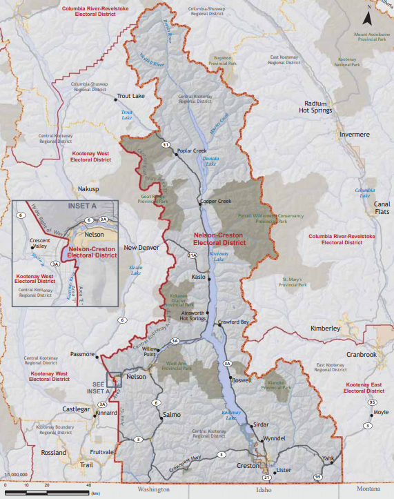
Nelson-Creston MLA Brittny Anderson says she would prefer her riding keep the status quo.
“I would love to see Nelson-Creston stay intact,” she says. “I think it makes a lot of sense considering we’re in the same regional district. I’ve developed great relationships across the riding. But I’ll accept whatever the panel decides.”
She notes that a key consideration that the commission has is to keep ridings to about 60,000 people, plus or minus 25 per cent. “We are very close to that in Nelson-Creston. I do think the larger the riding, the more challenging it is for constituents to access their MLA.”
The Nelson-Creston riding was created in 1933. The one major change to its boundaries was moving the Slocan Valley to neighbouring Kootenay West in the 2000s.
The Kootenay West riding has existed since 2009. From 2001-09, it was part of West Kootenay-Boundary, and from 1924 to 2001, it was known as Rossland-Trail.


