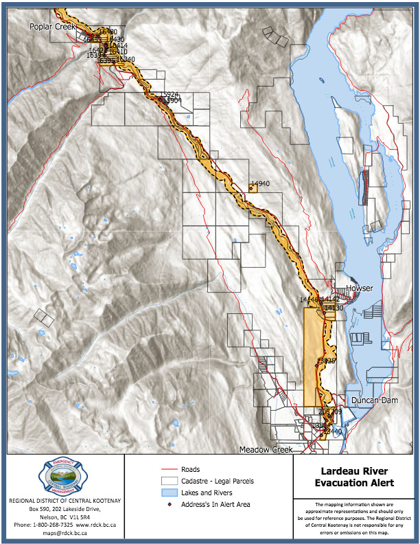
The Regional District of Central Kootenay has cancelled an evacuation alert for 25 properties along the Lardeau River.
It was issued Monday evening south from Poplar Creek to the confluence of the Lardeau and Duncan rivers due to the risk of flooding.
At the time, the RDCK noted the potential for heavy rain and thundershowers across the region.
However, they say that after consulting with the BC Water Stewardship branch, it was determined the river peaked last night just above a five-year return period.
“Thankfully the 100-year flood event did not happen over night and we are able to rescind the alert,” regional fire chief Nora Hannon said in a news release.
“However, due to the potential for more rain in the forecast and still a significant amount of snow pack, it is imperative for residents to be prepared and stay informed by monitoring local weather and current stream flows.”
A high streamflow advisory remains in effect for the entire West Kootenay. The RDCK says given the potential for unstable weather patterns over the next few days, plus increased snowmelt from a record setting snow pack, residents in the area need to remain vigilant and prepared.
The full list of properties that was covered by the alert is as follows:
| 14940 HWY 31 |
| 14146 HWY 31 |
| 14142 HWY 31 |
| 14130 HWY 31 |
| 15904 HWY 31 |
| 15924 HWY 31 |
| 13825 HWY 31 |
| 16340 HWY 31 |
| 16395 HWY 31 |
| 209 LARDEAU RIV RD |
| 16394 HWY 31 |
| 208 LARDEAU RIV RD |
| 16410 HWY 31 |
| 16412 HWY 31 |
| 16414 HWY 31 |
| 13544 HWY 31 |
| 16420 HWY 31 |
| 16422 HWY 31 |
| 16424 HWY 31 |
| 16430 HWY 31 |
| 13504 HWY 31 |
| 13440 HWY 31 |
| 16480 HWY 31 |
| 16471 HWY 31 |
| 16453 POPLAR CREEK FSR |
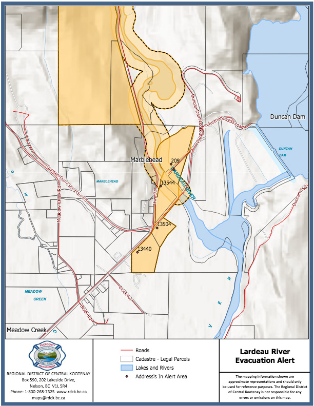
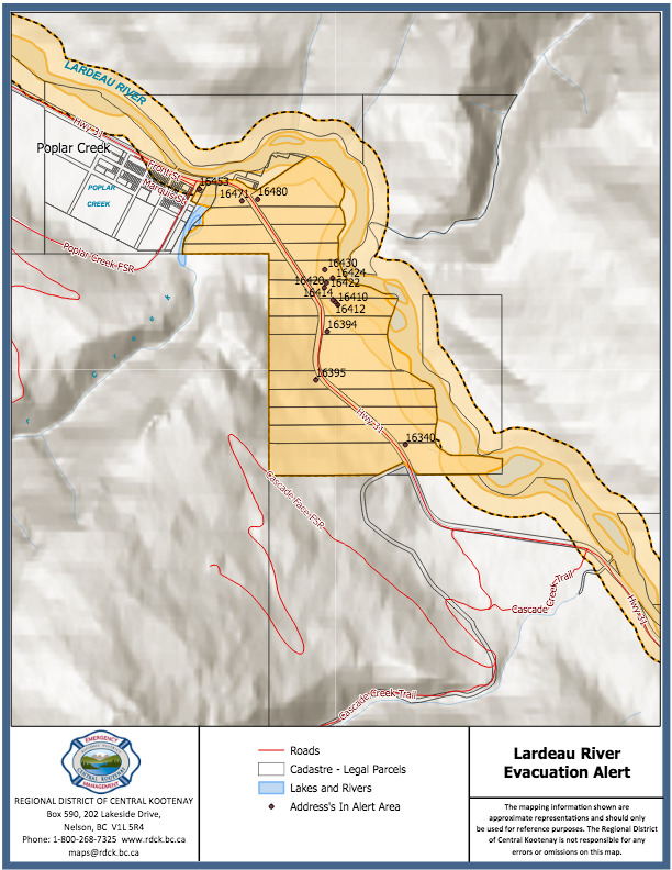
The maps below show details of the Marblehead and Poplar Creek properties on evacuation alert.


